The Project
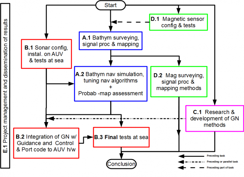
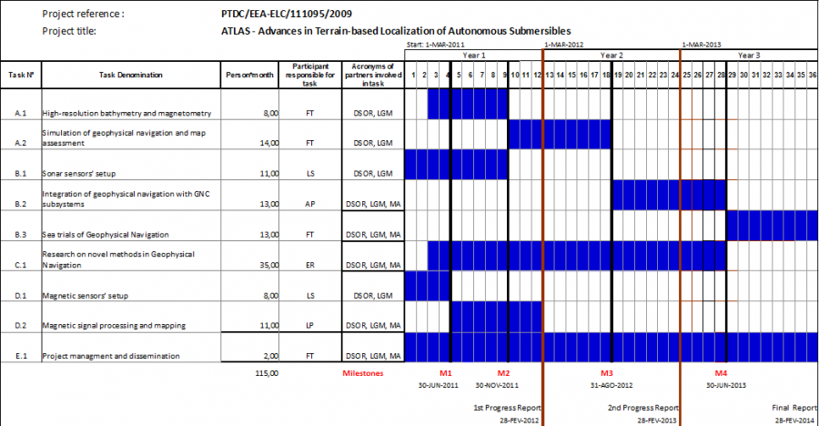
The main objective of the current project consists in the development of geophysical navigation (GN) methods with application to the navigation of autonomous underwater vehicles (AUVs). This approach to navigation relies essentially on matching the geophysical data acquired by a vehicle in real time with pre-existent maps of the area to be surveyed. It is an alternative, economical approach to dead-reckoning methods based on the integration of Inertial Navigation Sensor information and Doppler Velocity Logger data. One of the main advantages of GN is the possibility of eliminating the drifts that are inherent to the dead-reckoning methods. Geophysical Navigation is particularly well suited for the navigation of autonomous vehicles in areas that need to be surveyed repeatedly since the cost of acquiring the prior maps is diluted along time. As such, GN reveals high potential of application to oceanography in general and to marine geophysics in particular. This is an FCT project with the reference PTDC/EEA-ELC/111095/2009.
Introduction and Objectives
A great number of oceanographic missions consist of repeated surveys of the same area either for successive refinement of feature maps or for monitoring the evolution of the target environment along time. Examples of such missions include: marine surveillance in special areas of conservation; monitoring hydrothermal vents, mud volcanoes, and other geologically active areas of the sea-floor; habitat mapping; plankton sampling; mine detection and underwater archeology using sonar imaging and magnetometry; pipeline inspection; deployment of current profilers for sampling of small-scale ocean turbulence; inspection of scientific or industrial infrastructures.
Most of the repetitive tasks involved in these surveys can in principle be efficiently accomplished by Autonomous Underwater Vehicles (AUVs) provided that a reliable navigation system is available to estimate their position, velocity, and orientation, and to geo-reference the data acquired. Compared with other traditional methods, performing data acquisition with AUVs presents considerable benefits in terms of versatility, safety, operational costs, and quality of the data acquired. AUVs are ideal vehicles to execute missions that require 3-dimensional surveys in marine environments. Furthermore, because AUVs can penetrate the water column and maneuver close to the seabed in a controlled manner, they can acquire acoustic, magnetic, and vision data with a resolution that far exceeds that available with classical means.
One of the main advantages presented by autonomous underwater vehicles is the possibility of operating at depths where they are not affected by the environmental disturbances sensed by surface vessels or even by towed platforms. The inherent stability of AUVs makes them ideal for the acquisition of orientation-dependent data. Marine geophysical applications that can benefit from AUV deployed sensors include vector magnetometry and magnetic gradiometry. These techniques are routinely used in scientific research and oil exploration. In the last decades, following pioneer work at Woods-Hole Oceanographic Institution, near-bottom surveys in deep waters, including magnetic surveys that traditionally were performed with underwater towed vehicles, started to be executed by AUVs. In the near future, motivated by the increasing investment of the oil industry in deep water surveying for oil exploration and the flurry of scientific activity in the study of deep ocean habitats and the deployment of underwater laboratories, we expect to witness a surge of interest in AUVs instrumented for geophysical exploration.
Conventional AUV navigation methods rely on inertial navigation systems (INS) or acoustic baselines. High-performance INS are overly expensive units which are unaffordable to the majority of scientific and commercial applications. Medium and long baseline systems required by the aforementioned applications are cumbersome to deploy and pose additional problems in terms of calibration and maintenance that increase significantly the complexity of the navigation systems and the costs of operation. Geophysical Navigation (GN) is an alternative, economical approach that relies on matching the geophysical data acquired by a vehicle with pre-existent maps of the area to be surveyed. This method is particularly well suited for the navigation of autonomous vehicles in areas that need to be surveyed repeatedly since the cost of acquiring the prior maps is diluted along time. Previous work by the proponents of this project and other researchers has shown the potential of geophysical navigation based on sonar and magnetic data to implement autonomous underwater navigation.
Reportedly, some advanced naval systems employ measurements of geopotential fields (including gravity and geomagnetism) as navigation aids. It is known that geophysical navigation technologies have been applied on military submarines as a mean of compensating the drifts inherent to INS systems. Sonar bathymetric fix capabilities have been integrated in US Navy submarines for decades. Given the potential of their application in advanced weapon systems, in-depth studies involving these technologies remain withheld from general circulation for reasons of national security. To the best of our knowledge there is no current implementation of geophysical navigation systems for routine operations in civilian applications.
Motivated by the above open issues and borrowing from the previous experience of the research team, we propose in the current project to study, develop, and validate a number of geophysical navigation techniques experimentally. The project combines fundamental research with practical applications and is expected to foster the application of GN methods to small AUVs, thus contributing to making them affordable and bringing their potential to bear on the execution of challenging scientific and commercial applications.


